Amherst to Hudson is 317.3 miles and takes about 6h 14m via New York State Thruway, with a fuel budget near $52 and enough daylight to finish in a day. This trip stays within New York, beginning in the Northeast region and ending in the same area. You'll spend most of your time on the New York State Thruway, making for a straightforward, albeit long, single-day drive. Given the duration, consider an early start to ensure you arrive with plenty of daylight. This route is a practical choice if you're looking for an efficient way to cover ground between these two points in NY.
Trip Pace
Same-day drive is realistic
A same-day return is possible, but it will make for a full day on the road.
Break Rhythm
1 planned break
Plan on a short reset every 3 to 4 hours to stay fresh behind the wheel.
Midpoint
158.6 miles from Amherst, NY
A natural place for your longest stop of the day
, about 3h 4m into the drive
.
Main Roads
Road
Distance
Duration
New York State Thruway
305.7 mi
5h 53m
NY 9G
2.8 mi
5m
Youngmann Expressway
2.4 mi
3m
State Highway 23
1.7 mi
2m
Rip Van Winkle Bridge
1.3 mi
2m
CR 23B
0.5 mi
1m
Rhinebeck-Hudson Road
0.4 mi
<1m
Millersport Highway
0.4 mi
<1m
Longest stretch:
New York State Thruway
— 305.7 mi, about 5h 53m
Turn-by-Turn Driving Directions
Step-by-step road directions between Amherst, NY and Hudson, NY.
1
Start on NY 263
0.4 mi·50 sec·Millersport Highway
2
Take the ramp
0.3 mi·42 sec
Toward I 290 E
3
Merge onto I 290
2.4 mi·3 min·Youngmann Expressway
4
Keep slight left at fork
0.6 mi·57 sec
Exit 1-49Toward I 90 East: AlbanyUse the slight left / slight right lanes.
5
Merge onto I 90
271 mi·5 hr 13 min·New York State Thruway
Use the straight lane.
6
Keep slight right at fork onto New York State Thruway
35 mi·40 min·New York State Thruway
Toward I 87 South: New York, BostonUse the slight right lane.
Given this route can be completed in under 7 hours, it's a manageable one-day trip, so you can leave anytime that suits your schedule. Aiming for an early morning departure will give you ample time to reach Hudson and settle in before dark. The longest stretch without a significant change in road type is over 300 miles on the New York State Thruway, so plan for one primary fuel and rest stop during that segment. Keep an eye on your fuel gauge as you approach the end of the Thruway, as services can become less frequent on the subsequent surface roads.
Morning Departure
Start early — leave by 6-7 AM to arrive at a reasonable hour.
Evening Departure
This is a long drive — plan for a morning departure or consider splitting it into two days.
You can normally do this drive in one day.
Plan roughly 1 meaningful break for fuel, food, and rest.
The halfway point lands around 158.6 miles from Amherst, NY, or about 3h 4m into the drive.
The longest continuous stretch on this route runs about 305.7 miles.
This is a comfortable same-day trip.
Departure
Before you leave
Start with fuel, water, and navigation already sorted so the first hour feels easy.
First stop
Around 70 miles or 1h 22m in
Use this first pause for coffee, a restroom break, and a quick traffic check ahead.
Halfway reset
Around 158.6 miles or 3h 4m in
This is the best place for your longest stop, a real meal, and a full fuel check.
Final approach
Final hour starts around 5h 2m
Traffic, exits, and arrival timing usually matter more near Hudson, NY than in the middle of the route.
Before You Leave
+
Open the route before leaving Amherst, NY so your first major turns are already loaded.
+
Leave with enough water and a charging cable within reach, not packed away.
+
Check your fuel range against the first long segment, especially if you are starting outside city service areas.
Day 1
Settle into the route from Amherst, NY
This is one driving day of about 317.3 miles and 6h 14m.
Your first comfortable stop window is around 70 miles from Amherst, NY.
This route can stay practical as a one-day drive if traffic stays reasonable.
Plan about 1 real break rather than only quick fuel stops.
The longest stretch is on New York State Thruway for about 305.7 miles.
Where to Stop
Rest stops, refuel points, and overnight suggestions along this route.
Place data sourced from public business listings. Hours and availability may vary.
Heads-up: tricky spots
5 of 13
5 decision points cluster between mile 3.1 and 310.8 — GPS handles the exact turns, but know they're coming. Your lane choice matters more than the turn itself.
8
3.1 mi into trip|~4m in
Keep slight left at fork toward I 90 East: Albany
Highway fork - watch signs carefully. Lane positioning matters here
Use the slight left / slight right lanes.
Exit 1-49
Toward I 90 East: Albany
8
274.7 mi into trip|~5h 18m in|New York State Thruway
Keep slight right at fork onto New York State Thruway toward I 87 South: New York, Boston
Highway fork - watch signs carefully. Lane positioning matters here. Multiple destination signs - pick the right one
Use the slight right lane.
Toward I 87 South: New York, Boston
6
309.4 mi into trip|~5h 58m in
Take the exit toward NY 23: Catskill, Cairo
Exit ramp - move to the correct lane early. Multiple destination signs - pick the right one
Exit 21
Toward NY 23: Catskill, Cairo
7
310.3 mi into trip|~6h 1m in
Keep slight left at fork toward Catskill, Hudson, Tannersville, Hunter, Windham
Highway fork - watch signs carefully. Multiple destination signs - pick the right one
Toward Catskill, Hudson, Tannersville, Hunter,...
7
310.8 mi into trip|~6h 2m in
Take the exit toward NY 23 East: Hudson
Exit ramp - move to the correct lane early. Lane positioning matters here
Use the left lane.
Toward NY 23 East: Hudson
Fuel & Cost
Regular Gas
$51.33 one way
$102.66 round trip
$4.11/gal25.4 MPG avg111 kg CO2
Fuel Type
$/gal
One Way
Round Trip
midgrade
$4.46
$55.70
$111.40
premium
$4.85
$60.56
$121.12
diesel
$4.80
$59.91
$119.82
Estimated Tolls: $15.29
New York State Thruway
(305.7 mi)$15.29
Toll estimates based on average 2024-2025 rates. EZ-Pass/SunPass discounts may lower the actual cost.
Estimated Trip Cost (one way, 1 person)
Fuel
$51
Tolls
$15
Meals
$25–$50
Total
$92–$117
Rough estimate based on US averages. Hotel $80–$140/night, meals $25–$50/day.
Estimated CO2 emission: 111 kg one way.
Prices: EIA weekly data, 2026-07-13.
Driving Electric?
About $33 in charging
· 1 stop
· 67% less CO2
Vehicle Type
kWh
Stops
DC Fast
Home Charge
Average EV
95.2
1
$33.32
$15.23
Efficient EV
79.3
0
$27.76
$12.69
EV Truck/SUV
126.9
1
$44.42
$20.31
Gas CO2
111 kg
EV CO2
37 kg (67% less)
Plan for 1 charging stop. A 30-minute DC fast charge mid-route should be enough to complete the trip comfortably.
DC fast charging avg $0.35/kWh. Home charging avg $0.16/kWh. US grid CO2: 0.39 kg/kWh.
Travel Intel
Current conditions at both ends of the drive.
Forecast as of Jul 17, 2026
Origin
Amherst, NY
Late night
in Amherst on Monday
Local time
4:29 AM
EDT
Current temp
83°F
Smoke
SW 6 mph2% chanceLive forecast
Destination
Hudson, NY
Late night
in Hudson on Monday
Local time
4:29 AM
EDT
Current temp
83°F
Sunny
NW 3 mph0% chanceLive forecast
Seasonal Notes
Summer travel usually means heavier construction, hotter rest stops, and busier weekend traffic around major cities.
Winter travel shortens daylight, so a route that looks manageable on paper can feel much longer after dark.
Holiday weekends tend to make both departure and arrival windows slower than the raw route time suggests.
Time zone
Same local time
Origin and destination are on the same clock, so arrival timing is easier to judge at a glance.
Temperature spread
Very similar conditions
Both ends of the route are sitting at about the same temperature right now.
Road read
6h 14m on the road
Start early — leave by 6-7 AM to arrive at a reasonable hour.
Weather data from the National Weather Service. Conditions may change; check closer to your travel date.
National Parks Near This Route
Worth a detour if your schedule allows.
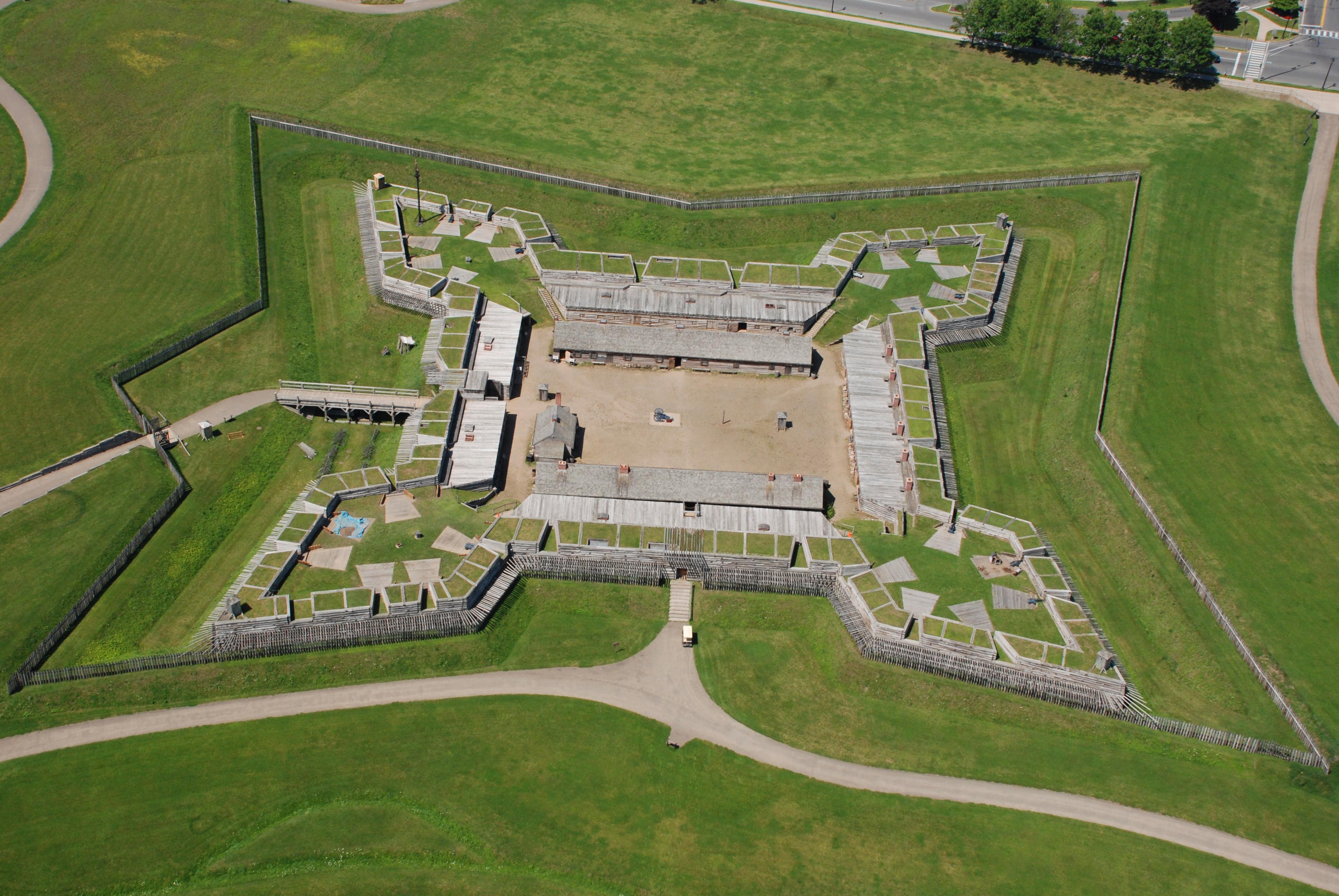
Fort Stanwix National Monument
National Monument
For centuries, the Oneida Carrying Place, a six-mile portage connecting the Mohawk River and Wood Creek, served as a vital link for those traveling by water from the ocean to the Great Lakes. When Eur...
6 mi from route
~14 min detour
Free
near mile 175.1
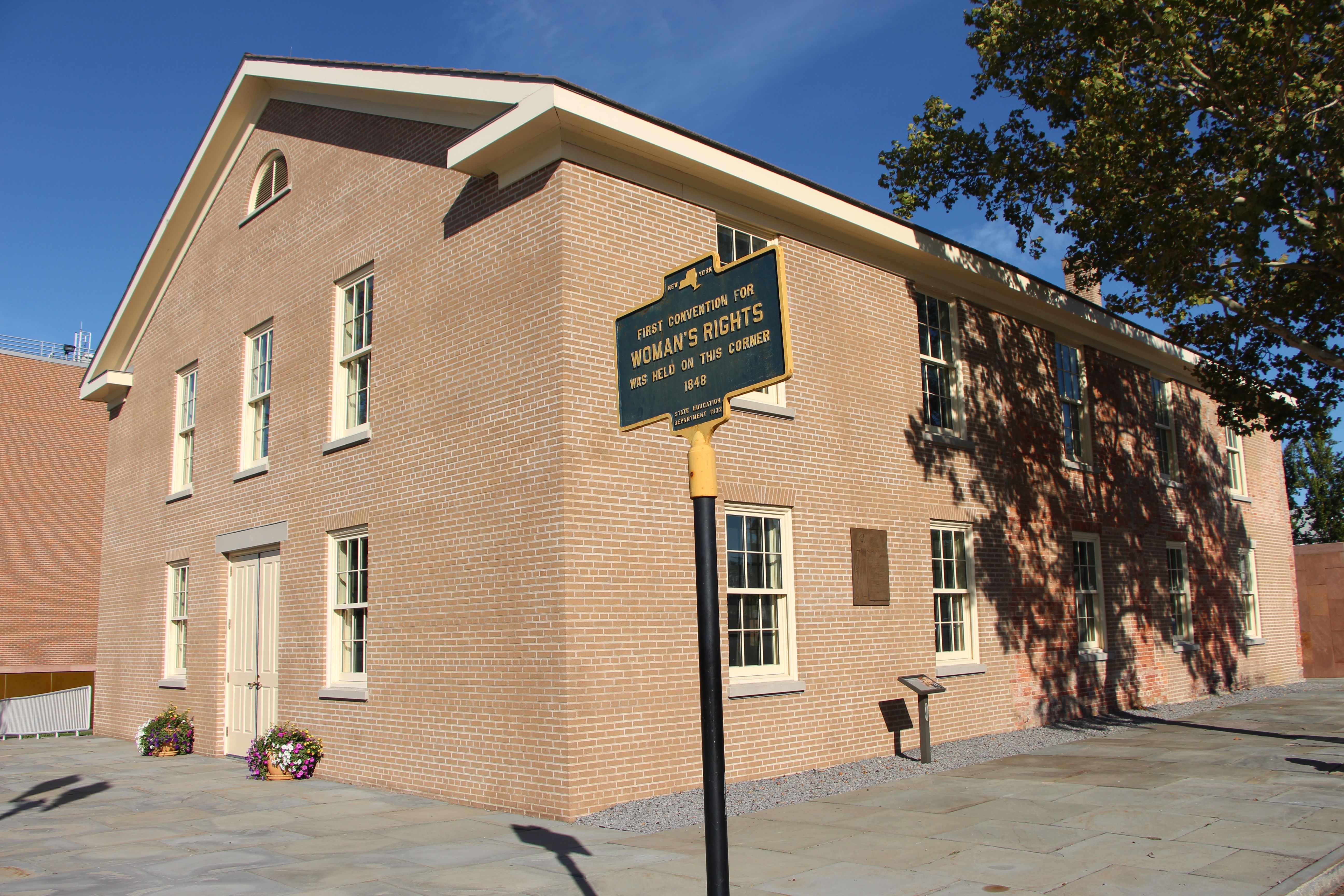
Women’s Rights National Historical Park tells the story of the first Women’s Rights Convention, held in Seneca Falls, New York on July 19-20, 1848. It is a story of struggles for civil rights, human r...
7 mi from route
~18 min detour
Free
near mile 109.4
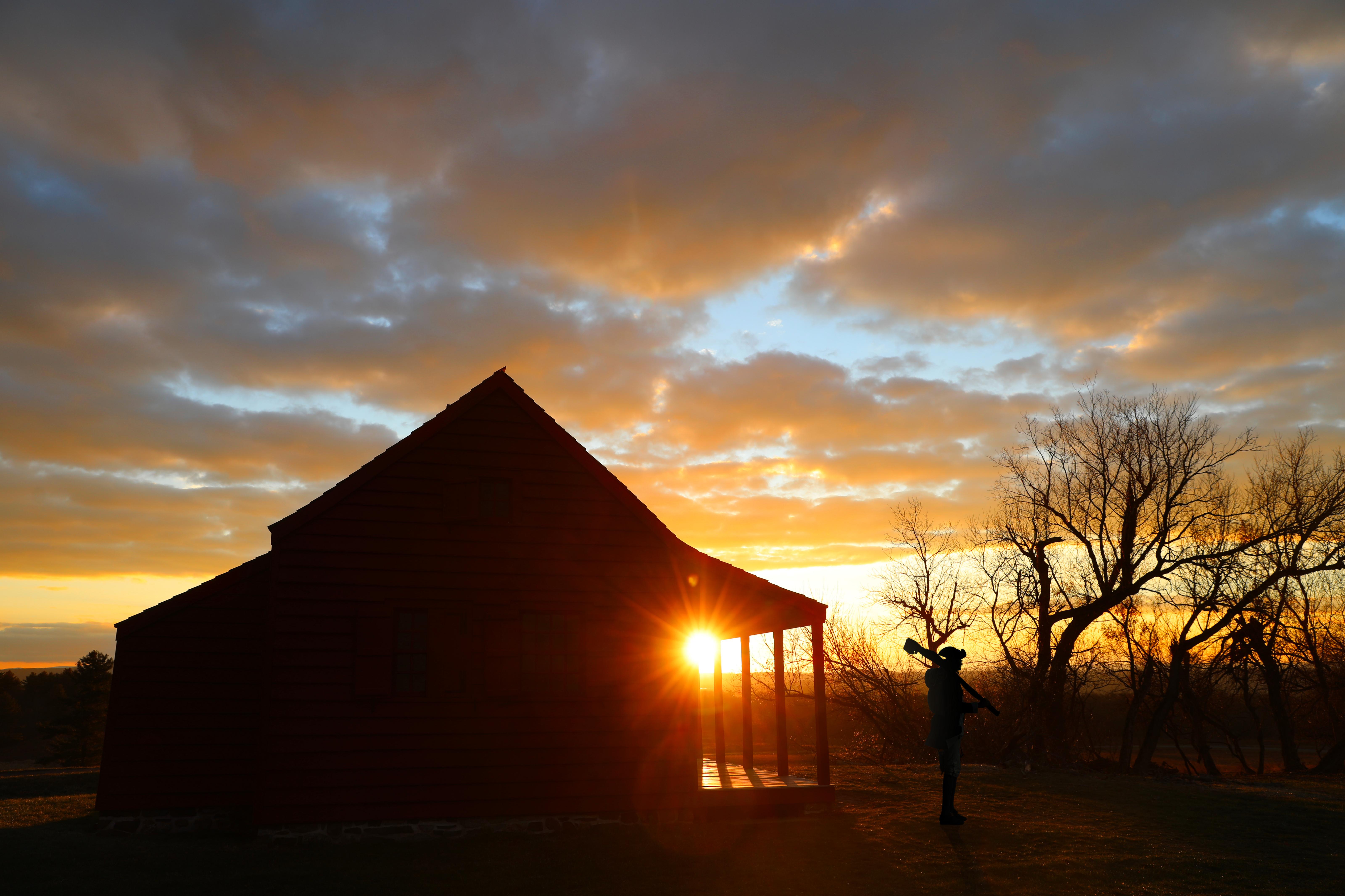
Harriet Tubman was guided by a deep faith and devotion to family, freedom, and community. After emancipating herself and members of her family, she moved them from Ontario, Canada to Fleming and Aubur...
10 mi from route
~26 min detour
Free
near mile 109.4
In 1777, a large British invasion force met an equally large American army here at Saratoga. After two intense battles, an eight-mile retreat, and a three-day siege, British General John Burgoyne surr...
23 mi from route
~57 min detour
Free
near mile 273.5
Park data from the National Park Service API. Alerts update every 2 hours.
More Details
What kind of drive is this?
This drive is primarily highway, with a 100% highway share. You'll cover 305.7 miles on the New York State Thruway before transitioning to surface roads like NY 9G. The Youngmann Expressway also plays a role in getting you onto the main thoroughfare. Expect consistent cruising for the vast majority of the trip, with the highway section offering a continuous driving experience before you reach the more local roads closer to your destination.
Only 1% highway — the rest is turn-by-turn surface driving.
18 navigation steps total — most of the decisions cluster near the start and finish.
Longest single stretch: 305.7 mi on New York State Thruway.
How Hard Is This Drive?
9/10
Expect a hands-on drive with frequent turns and local roads rather than long highway stretches. This route has several spots where lane changes, forks, or exits need your full attention. The trickiest moment comes around 3.1 miles in.
Driving Effort9/10
High effort - long or complex enough to need steady focus all day
Balances navigation complexity with total wheel time.
This is a demanding drive. With 13 significant decision points across 317.3 miles, you will need to stay alert - especially through interchange areas and urban stretches. Consider splitting it into segments if you are not comfortable with fast highway navigation.
Where does it get tricky?
The main spots that need attention: at 3.1 miles: Highway fork - watch signs carefully. Lane positioning matters here; at 274.7 miles (New York State Thruway): Highway fork - watch signs carefully. Lane positioning matters here. Multiple destination signs - pick the right one; at 309.4 miles: Exit ramp - move to the correct lane early. Multiple destination signs - pick the right one.
Elevation Profile
Mostly flat terrain
844 ft86 ft
Total Climb
501 ft
Total Descent
1,012 ft
Highest Point
844 ft
~22.7 mi in
Elevation Range
758 ft
Towns Mentioned on Route Signs
Based on OSRM destination-sign hints, not a full list of every settlement the road passes.
On the drive from Amherst, NY to Hudson, NY, road signs begin pointing toward Boston along the way.
Doable as a same-day drive at 6h 14m. Total distance: 317.3 miles.
Family Friendly
Moderate complexity with 1 natural rest stops along the way.
Solo Traveler
6h 14m drive, plan rest stops for pacing.
Scenic Drive
Mostly surface roads route profile with national parks nearby.
Frequently Asked Questions
The longest stretch is about 305.7 miles on New York State Thruway. The full list of main roads is in the Roads section above.
Expect about $15.29 in tolls one way, starting with New York State Thruway. Most Northeast and Midwest toll agencies accept E-ZPass; in the West and Texas, transponders like TxTag or FasTrak apply. If you do not have a transponder, cashless tolling plates will mail a bill to the vehicle's registered address — usually with a surcharge, so a rental-car toll pass is often cheaper than paying by mail.
Yes — we found about 39 rest areas or service plazas within a short detour of the route (from OpenStreetMap). See the Rest Stops tab under Nearby Places for locations and mile markers. Plan to stretch, use the bathroom, and top off fluids every 2–3 hours on longer drives.
It helps. This route has a higher-than-average number of complex decision points, which get harder in the dark. If the last hour of the trip is on surface roads or mountain grades, aim to arrive at Hudson, NY before sunset when you can. Check the Trip Plan for departure windows that land you in daylight.
Only with planning. This is a long drive for kids — consider splitting it into two days rather than pushing through. Plan at least 1 meaningful breaks. There are 39 rest areas along the route for bathroom stops.
The main spots that need attention: at 3.1 miles: Highway fork - watch signs carefully. Lane positioning matters here; at 274.7 miles (New York State Thruway): Highway fork - watch signs carefully. Lane positioning matters here. Multiple destination signs - pick the right one; at 309.4 miles: Exit ramp - move to the correct lane early. Multiple destination signs - pick the right one.
Yes — Fort Stanwix National Monument, Women's Rights National Historical Park and Harriet Tubman National Historical Park (4 total within detour distance). See the National Parks section for detour distances and tips on detours.
Not recommended in a single day. At 6.2 hours each way, a round trip means 12.5 hours of driving — that is an unsafe level of fatigue for most drivers. Plan at least one night at Hudson, NY before the return drive.