This 54.3-mile drive from Alstead, NH to Concord, NH is a straightforward, manageable trip that can easily be completed in about 1 hour and 32 minutes, making it an ideal day trip. The journey utilizes a mix of main roads, including Franklin Pierce Highway, Route 123 North, and a portion of I-89. With a modest fuel cost estimated at $9, it's an economical option for exploring the Northeast region. The route offers a mixed driving profile, suggesting a varied experience rather than a monotonous stretch. You'll be traveling within New Hampshire for the entire duration of this trip.
Trip Pace
Same-day drive is realistic
A same-day return is realistic if you keep stops short.
Midpoint
27.1 miles from Alstead, NH
A natural place for your longest stop of the day
, about 53m into the drive
.
Main Roads
Road
Distance
Duration
Franklin Pierce Highway
16.3 mi
22m
Route 123 North
7.4 mi
14m
I 89
6 mi
6m
Keene Road
5.7 mi
8m
NH Route 123
4.8 mi
12m
Forest Road
4.7 mi
11m
Route 9
2.3 mi
3m
West Main Street
1.9 mi
2m
Longest stretch:
Franklin Pierce Highway
— 16.3 mi, about 22m
Turn-by-Turn Driving Directions
Step-by-step road directions between Alstead, NH and Concord, NH.
1
Start on NH 12A; NH 123
0.6 mi·1 min·Mechanic Street
2
Continue on NH 12A; NH 123
4.7 mi·11 min·Forest Road
3
Continue on NH 123
4.8 mi·12 min·NH Route 123
4
At end of road, turn right onto NH 10; NH 123
273 ft·6 sec·Dartmouth College Road
5
Continue on NH 10; NH 123
1.0 mi·1 min·State Route 10
6
Turn left onto NH 123
0.2 mi·18 sec·Telephone Road
7
Turn slight left onto NH 123
0.3 mi·28 sec·Forest Road East
8
Continue on NH 123
7.4 mi·14 min·Route 123 North
9
At end of road, turn left onto NH 9
2.3 mi·3 min·Route 9
10
Continue on NH 9
5.7 mi·8 min·Keene Road
11
Continue on NH 9; NH 31
1.9 mi·2 min·West Main Street
12
Turn straight onto NH 9
16 mi·22 min·Franklin Pierce Highway
Use the straight lane.
13
Merge onto I 89
6.0 mi·6 min·I 89
14
Take the exit
0.2 mi·33 sec
Exit 2Toward NH 13: Concord
15
Keep slight right at fork
251 ft·6 sec
16
Turn right onto NH 13
1.8 mi·4 min·Clinton Street
Use the straight lane.
17
Turn left onto NH 13
0.6 mi·1 min·South Street
Use the left lane.
18
Turn right onto US 202; NH 9
0.1 mi·22 sec·Pleasant Street
Use the right lane.
19
Turn left onto North State Street
0.3 mi·53 sec·North State Street
20
Turn right onto Centre Street
486 ft·14 sec·Centre Street
Use the right lane.
21
Turn right
74 ft·12 sec
22
Arrive at destination
Trip Plan
Given the relatively short duration of 1 hour and 32 minutes for this 54.3-mile journey, you have the flexibility to depart at your convenience. Consider leaving in the morning to maximize your day in Concord or departing later in the afternoon for a more relaxed arrival. The fuel cost is estimated at a low $9, so refueling isn't a major concern. Keep an eye out for transitions between Franklin Pierce Highway and Route 123 North, as these shifts can sometimes involve changes in speed limits and road conditions.
Morning Departure
Leave by 9 AM and you'll arrive before lunch.
Evening Departure
Even a 4 PM departure gets you there before dark in summer.
You can normally do this drive in one day.
You may only need one short stretch break if traffic stays light.
The halfway point lands around 27.1 miles from Alstead, NH, or about 53m into the drive.
The longest continuous stretch on this route runs about 16.3 miles.
This is a comfortable same-day trip.
Departure
Before you leave
Start with fuel, water, and navigation already sorted so the first hour feels easy.
First stop
Around 12 miles or 27m in
Use this first pause for coffee, a restroom break, and a quick traffic check ahead.
Halfway reset
Around 27.1 miles or 53m in
This is the best place for your longest stop, a real meal, and a full fuel check.
Final approach
Final hour starts around 1h 19m
Traffic, exits, and arrival timing usually matter more near Concord, NH than in the middle of the route.
Before You Leave
+
Open the route before leaving Alstead, NH so your first major turns are already loaded.
Day 1
Settle into the route from Alstead, NH
This is one driving day of about 54.3 miles and 1h 32m.
Your first comfortable stop window is around 12 miles from Alstead, NH.
This route can stay practical as a one-day drive if traffic stays reasonable.
The longest stretch is on Franklin Pierce Highway for about 16.3 miles.
Where to Stop
Rest stops, refuel points, and overnight suggestions along this route.
The midpoint is around 27.1 miles from Alstead, NH, which is a good place for a longer meal and fuel stop.
These stop ideas are pacing suggestions — the exact town or exit can change with traffic, hotel plans, and fuel range.
Heads-up: tricky spots
5 of 13
5 decision points cluster between mile 51.1 and 54.2 — GPS handles the exact turns, but know they're coming. Your lane choice matters more than the turn itself.
5
51.1 mi into trip|~1h 24m in
Take the exit toward NH 13: Concord
Exit ramp - move to the correct lane early
Exit 2
Toward NH 13: Concord
5
51.3 mi into trip|~1h 25m in
Keep slight right at fork
Highway fork - watch signs carefully
5
51.4 mi into trip|~1h 25m in|NH 13 / Clinton Street
Turn right onto NH 13 / Clinton Street
Lane positioning matters here
Use the straight lane.
5
53.8 mi into trip|~1h 31m in|US 202; NH 9 / Pleasant Street
Turn right onto US 202; NH 9 / Pleasant Street
Lane positioning matters here
Use the right lane.
6
54.2 mi into trip|~1h 32m in|Centre Street
Turn right onto Centre Street
Lane positioning matters here
Use the right lane.
Fuel & Cost
Regular Gas
$8.74 one way
$17.48 round trip
$4.09/gal25.4 MPG avg19 kg CO2
Fuel Type
$/gal
One Way
Round Trip
midgrade
$4.50
$9.62
$19.24
premium
$4.86
$10.40
$20.80
diesel
$5.61
$11.99
$23.98
No toll roads detected on this route.
Estimated Trip Cost (one way, 1 person)
Fuel
$9
Meals
$25–$50
Total
$34–$59
Rough estimate based on US averages. Hotel $80–$140/night, meals $25–$50/day.
Estimated CO2 emission: 19 kg one way.
Prices: EIA weekly data, 2026-04-13.
Driving Electric?
About $6 in charging
· 0 stops
· 68% less CO2
Vehicle Type
kWh
Stops
DC Fast
Home Charge
Average EV
16.3
0
$5.70
$2.61
Efficient EV
13.6
0
$4.75
$2.17
EV Truck/SUV
21.7
0
$7.60
$3.48
Gas CO2
19 kg
EV CO2
6 kg (68% less)
This trip is well within single-charge range for most EVs. No charging stops needed if you start fully charged.
DC fast charging avg $0.35/kWh. Home charging avg $0.16/kWh. US grid CO2: 0.39 kg/kWh.
Travel Intel
Current conditions at both ends of the drive.
Forecast as of Apr 14, 2026
Origin
Alstead, NH
Late night
in Alstead on Sunday
Local time
12:20 AM
EDT
Current temp
80°F
Chance Showers And Thunderstorms
S 5 mph34% chanceLive forecast
Destination
Concord, NH
Late night
in Concord on Sunday
Local time
12:20 AM
EDT
Current temp
81°F
Chance Showers And Thunderstorms
SE 5 mph28% chanceLive forecast
Seasonal Notes
Summer travel usually means heavier construction, hotter rest stops, and busier weekend traffic around major cities.
Winter travel shortens daylight, so a route that looks manageable on paper can feel much longer after dark.
Holiday weekends tend to make both departure and arrival windows slower than the raw route time suggests.
Time zone
Same local time
Origin and destination are on the same clock, so arrival timing is easier to judge at a glance.
Temperature spread
1 degrees warmer at arrival
A meaningful temperature swing is a good cue to rethink layers, water, and how soon you want to arrive.
Road read
1h 32m on the road
The weather snapshot is not static. If you are leaving later, give both cities one more quick forecast check before departure.
Weather data from the National Weather Service. Conditions may change; check closer to your travel date.
National Parks Near This Route
Worth a detour if your schedule allows.
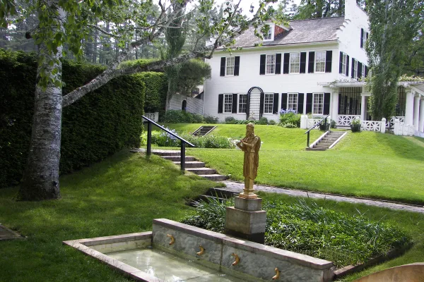
Saint-Gaudens National Historical Park
National Historical Park
Your National Park for the Arts preserves the home and studio of sculptor Augustus Saint-Gaudens (1848-1907). Here stories flow through a landscape of inspiration. Discover the history behind the capt...
Park data from the National Park Service API. Alerts update every 2 hours.
More Details
What kind of drive is this?
This drive presents a mixed driving profile, with about 40% of the journey on highways. You'll experience stretches on Franklin Pierce Highway, which accounts for the longest uninterrupted segment at 16.3 miles, offering a more direct path. The route transitions between these primary roads and sections of Route 123 North, likely providing a varied feel as you progress towards Concord. Expect a blend of faster-paced highway driving and potentially more local road navigation.
40% highway, the rest on surface roads — varied driving throughout.
22 navigation steps total — most of the decisions cluster near the start and finish.
Longest single stretch: 16.3 mi on Franklin Pierce Highway.
How Hard Is This Drive?
6/10
This route mixes highway mileage with some local-road sections near the start or finish. You will hit about 13 points where you need to pay attention to lane position or signs. The trickiest moment comes around 51.1 miles in.
Driving Effort6/10
Moderate - straightforward overall, but long enough or busy enough to require pacing
Balances navigation complexity with total wheel time.
This drive requires moderate attention. Across 54.3 miles you will encounter 13 spots where lane choice or exit timing matters. Not difficult for experienced highway drivers, but worth previewing the tricky sections before you go.
Where does it get tricky?
The main spots that need attention: at 51.1 miles: Exit ramp - move to the correct lane early; at 51.3 miles: Highway fork - watch signs carefully; at 51.4 miles (NH 13 / Clinton Street): Lane positioning matters here.
Elevation Profile
Gently rolling terrain
1,568 ft271 ft
Total Climb
1,230 ft
Total Descent
1,438 ft
Highest Point
1,568 ft
~15.5 mi in
Elevation Range
1,297 ft
Who Is This Route For?
Weekend Trip
Doable as a same-day drive at 1h 32m. Total distance: 54.3 miles.
Family Friendly
Moderate complexity with 0 natural rest stops along the way.
Solo Traveler
1h 32m drive, comfortable solo distance.
First-Time Driver
Mostly highway driving (40%). Some complex stretches to watch for.
Scenic Drive
Mixed highway & surface route profile with national parks nearby.
Frequently Asked Questions
The longest stretch is about 16.3 miles on Franklin Pierce Highway. The full list of main roads is in the Roads section above.
It helps. This route has a higher-than-average number of complex decision points, which get harder in the dark. If the last hour of the trip is on surface roads or mountain grades, aim to arrive at Concord, NH before sunset when you can. Check the Trip Plan for departure windows that land you in daylight.
Yes. At under 2 hours behind the wheel, this works well for families — plan one quick stop if you have younger kids.
Mostly yes along the main roads, but rural stretches through NH can have sparse or no coverage. Before you leave, download offline Google Maps or Apple Maps for the route, and consider downloading music or podcasts instead of streaming. If you depend on data for navigation, keep a paper backup of the turn-by-turn directions.
The main spots that need attention: at 51.1 miles: Exit ramp - move to the correct lane early; at 51.3 miles: Highway fork - watch signs carefully; at 51.4 miles (NH 13 / Clinton Street): Lane positioning matters here.
Yes — Saint-Gaudens National Historical Park. See the National Parks section for detour distances and tips on detours.
Yes. A round trip is manageable in a single day if you plan a break at Concord, NH before heading back.