Akron to Amanda is 159.6 miles and takes about 3 hours 7 minutes via I-71 and Southeast Expressway, with a fuel budget near $25 and enough daylight to finish in a day. This trip stays within the Midwest region, traveling entirely within Ohio. It's a straightforward, highway-focused drive that's ideal for a single-day excursion. Given its manageable length and duration, it's a convenient option for a quick getaway or a necessary transit leg.
Trip Pace
Same-day drive is realistic
A same-day return is realistic if you keep stops short.
Break Rhythm
1 planned break
A short stop every 2 to 3 hours is enough for this drive.
Midpoint
79.8 miles from Akron, OH
A natural place for your longest stop of the day
, about 1h 32m into the drive
.
Main Roads
Road
Distance
Duration
I 71
100.7 mi
1h 49m
Kenmore Expressway
19.8 mi
24m
Southeast Expressway
8.8 mi
11m
Columbus-Lancaster Road Northwest
7.6 mi
9m
Lancaster Bypass
7.2 mi
7m
Cincinnati-Zanesville Road Southwest
5.8 mi
8m
East Freeway
3 mi
4m
Innerbelt
1.8 mi
2m
Longest stretch:
I 71
— 100.7 mi, about 1h 49m
Turn-by-Turn Driving Directions
Step-by-step road directions between Akron, OH and Amanda, OH.
1
Start on West Bowery Street
0.2 mi·36 sec·West Bowery Street
2
Turn right onto West Center Street
0.2 mi·37 sec·West Center Street
3
At end of road, turn left onto SR 59
0.1 mi·15 sec·Rand Avenue
4
Turn straight onto SR 59
1.8 mi·2 min·Innerbelt
5
Merge onto I 76; I 77
1.0 mi·1 min·I 76; I 77
6
Keep slight right at fork onto I 76
20 mi·24 min·Kenmore Expressway
Toward I 76 West: BarbertonUse the straight / slight right lanes.
7
Take the exit
1.2 mi·2 min
Exit 1AToward I 71 South: ColumbusUse the slight right lane.
8
Merge onto I 71
101 mi·1 hr 49 min·I 71
Use the straight / slight right lanes.
9
Take the exit
0.8 mi·1 min
Exit 107Toward I 70 East: WheelingUse the slight left lane.
10
Merge onto I 70
3.0 mi·4 min·East Freeway
Use the straight lane.
11
Take the exit
0.3 mi·37 sec
Exit 105AToward US 33 East: LancasterUse the slight right lane.
12
Continue on US 33
0.3 mi·29 sec·College Avenue
Use the straight lane.
13
Keep slight right at fork onto US 33
8.8 mi·11 min·Southeast Expressway
Use the straight lane.
14
Continue on US 33
7.6 mi·9 min·Columbus-Lancaster Road Northwest
Use the straight / slight right lanes.
15
Continue on US 33
7.2 mi·7 min·Lancaster Bypass
Use the straight / slight right lanes.
16
Take the exit
0.3 mi·34 sec
Exit 153Toward US 22: Lancaster, Circleville, Fairfield County FairgroundsUse the slight right lane.
17
Turn right onto US 22
0.9 mi·1 min·Cincinnati-Zanesville Road Southwest
18
Enter roundabout onto US 22
135 ft·2 sec·Cincinnati-Zanesville Road Southwest
19
Continue on US 22
509 ft·8 sec·Cincinnati-Zanesville Road Southwest
20
Enter roundabout onto US 22
95 ft·1 sec·Cincinnati-Zanesville Road Southwest
21
Continue on US 22
4.7 mi·7 min·Cincinnati-Zanesville Road Southwest
22
Turn left onto Amanda-Northern Road
0.1 mi·15 sec·Amanda-Northern Road
23
Continue on West Main Street
0.4 mi·1 min·West Main Street
24
Arrive at destination
West Main Street
Trip Plan
With a drive time of just over three hours, this route is perfectly suited for a same-day trip, allowing you to leave anytime and still have plenty of daylight remaining. The estimated fuel cost is around $25, so plan your stops accordingly, especially considering the longest stretch without a major exit is over 100 miles. While there's only one recommended stop, be mindful of your fuel gauge as you approach the latter half of the drive on I-71 to avoid any unexpected delays.
Morning Departure
An early start around 7-8 AM gets you there with plenty of daylight left.
Evening Departure
A late afternoon start means arriving after dark. Morning is better.
You can normally do this drive in one day.
Plan roughly 1 meaningful break for fuel, food, and rest.
The halfway point lands around 79.8 miles from Akron, OH, or about 1h 32m into the drive.
The longest continuous stretch on this route runs about 100.7 miles.
This is a comfortable same-day trip.
Departure
Before you leave
Start with fuel, water, and navigation already sorted so the first hour feels easy.
First stop
Around 35 miles or 44m in
Use this first pause for coffee, a restroom break, and a quick traffic check ahead.
Halfway reset
Around 79.8 miles or 1h 32m in
This is the best place for your longest stop, a real meal, and a full fuel check.
Final approach
Final hour starts around 2h 30m
Traffic, exits, and arrival timing usually matter more near Amanda, OH than in the middle of the route.
Before You Leave
+
Open the route before leaving Akron, OH so your first major turns are already loaded.
+
Leave with enough water and a charging cable within reach, not packed away.
+
Check your fuel range against the first long segment, especially if you are starting outside city service areas.
Day 1
Settle into the route from Akron, OH
This is one driving day of about 159.6 miles and 3h 7m.
Your first comfortable stop window is around 35 miles from Akron, OH.
This route can stay practical as a one-day drive if traffic stays reasonable.
Plan about 1 real break rather than only quick fuel stops.
The longest stretch is on I 71 for about 100.7 miles.
Where to Stop
Rest stops, refuel points, and overnight suggestions along this route.
Place data sourced from public business listings. Hours and availability may vary.
Heads-up: tricky spots
5 of 15
5 decision points cluster between mile 3.3 and 153.1 — GPS handles the exact turns, but know they're coming. Your lane choice matters more than the turn itself.
7
3.3 mi into trip|~5m in|I 76 / Kenmore Expressway
Keep slight right at fork onto I 76 / Kenmore Expressway toward I 76 West: Barberton
Highway fork - watch signs carefully. Lane positioning matters here
Use the straight / slight right lanes.
Toward I 76 West: Barberton
7
23.1 mi into trip|~29m in
Take the exit toward I 71 South: Columbus
Exit ramp - move to the correct lane early. Lane positioning matters here
Use the slight right lane.
Exit 1A
Toward I 71 South: Columbus
7
125.1 mi into trip|~2h 21m in
Take the exit toward I 70 East: Wheeling
Exit ramp - move to the correct lane early. Lane positioning matters here
Use the slight left lane.
Exit 107
Toward I 70 East: Wheeling
7
128.9 mi into trip|~2h 27m in
Take the exit toward US 33 East: Lancaster
Exit ramp - move to the correct lane early. Lane positioning matters here
Use the slight right lane.
Exit 105A
Toward US 33 East: Lancaster
8
153.1 mi into trip|~2h 56m in
Take the exit toward US 22: Lancaster, Circleville, Fairfield County Fairgrounds
Exit ramp - move to the correct lane early. Lane positioning matters here. Multiple destination signs - pick the right one
Use the slight right lane.
Exit 153
Toward US 22: Lancaster, Circleville, Fairfield...
Fuel & Cost
Regular Gas
$24.77 one way
$49.54 round trip
$3.94/gal25.4 MPG avg56 kg CO2
Fuel Type
$/gal
One Way
Round Trip
midgrade
$4.38
$27.49
$54.98
premium
$4.91
$30.85
$61.69
diesel
$5.61
$35.24
$70.48
No toll roads detected on this route.
Estimated Trip Cost (one way, 1 person)
Fuel
$25
Meals
$25–$50
Total
$50–$75
Rough estimate based on US averages. Hotel $80–$140/night, meals $25–$50/day.
Estimated CO2 emission: 55.8 kg one way.
Prices: EIA weekly data, 2026-04-13.
Driving Electric?
About $17 in charging
· 0 stops
· 66% less CO2
Vehicle Type
kWh
Stops
DC Fast
Home Charge
Average EV
47.9
0
$16.76
$7.66
Efficient EV
39.9
0
$13.96
$6.38
EV Truck/SUV
63.8
0
$22.34
$10.21
Gas CO2
56 kg
EV CO2
19 kg (66% less)
This trip is well within single-charge range for most EVs. No charging stops needed if you start fully charged.
DC fast charging avg $0.35/kWh. Home charging avg $0.16/kWh. US grid CO2: 0.39 kg/kWh.
Travel Intel
Current conditions at both ends of the drive.
Forecast as of Apr 15, 2026
Origin
Akron, OH
Late night
in Akron on Sunday
Local time
3:55 AM
EDT
Current temp
59°F
Unavailable
Live forecast
Destination
Amanda, OH
Late night
in Amanda on Sunday
Local time
3:55 AM
EDT
Current temp
47°F
Unavailable
Live forecast
68°F
Mansfield, OH
80 mi in
Seasonal Notes
Summer travel usually means heavier construction, hotter rest stops, and busier weekend traffic around major cities.
Winter travel shortens daylight, so a route that looks manageable on paper can feel much longer after dark.
Holiday weekends tend to make both departure and arrival windows slower than the raw route time suggests.
Time zone
Same local time
Origin and destination are on the same clock, so arrival timing is easier to judge at a glance.
Temperature spread
12 degrees cooler at arrival
A meaningful temperature swing is a good cue to rethink layers, water, and how soon you want to arrive.
Road read
3h 7m on the road
Use the two city cards together: check the sky where you start, then compare it with the local time and temperature at arrival.
Weather data from the National Weather Service. Conditions may change; check closer to your travel date.
National Parks Near This Route
Worth a detour if your schedule allows.
Cuyahoga Valley National Park
National Park
Though a short distance from the urban areas of Cleveland and Akron, Cuyahoga Valley National Park seems worlds away. The park is a refuge for native plants and wildlife, and provides routes of discov...
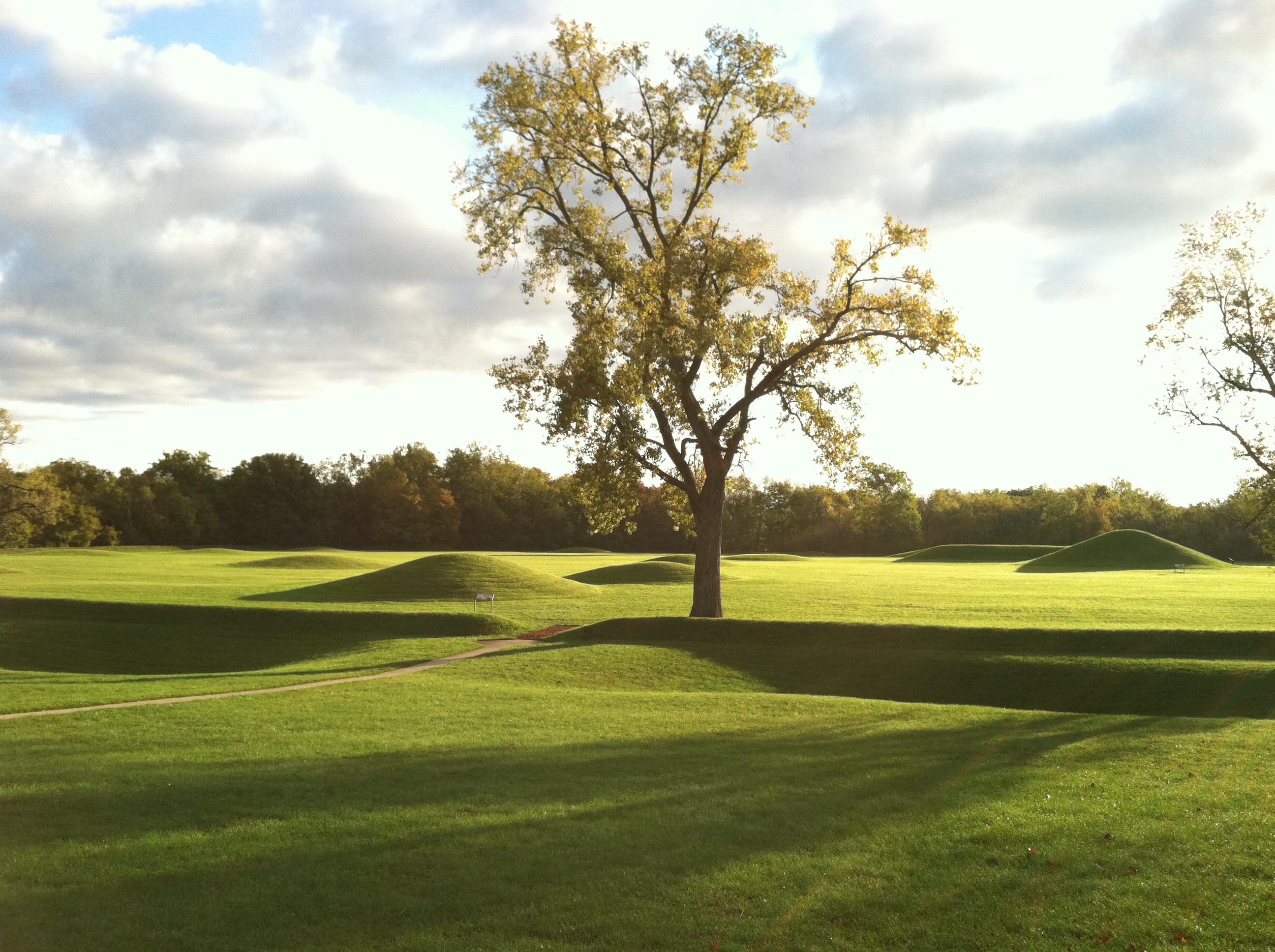
Nearly 2000 years ago, Native Americans built dozens of monumental mounds and earthen enclosures in southern Ohio. These earthwork complexes were ceremonial landscapes used for feasts, funerals, ritua...
29 mi from route
~73 min detour
Free
near mile 159.6
Park data from the National Park Service API. Alerts update every 2 hours.
More Details
What kind of drive is this?
This route is predominantly a highway-focused drive, with 84% of the journey taking place on major interstates and expressways like I-71, Kenmore Expressway, and Southeast Expressway. You'll experience a long, uninterrupted stretch of 100.7 miles primarily on I-71, making for efficient travel. The character of the drive is largely consistent, characterized by higher speed limits and a focus on covering ground rather than leisurely sightseeing. Expect a steady pace for the majority of the 3 hours and 7 minutes.
84% highway — fuel and pacing are the main things to plan.
24 navigation steps total — most of the decisions cluster near the start and finish.
Longest single stretch: 100.7 mi on I 71.
How Hard Is This Drive?
8/10
This is a straightforward highway drive that stays mostly on I 71 and Kenmore Expressway. This route has several spots where lane changes, forks, or exits need your full attention. The trickiest moment comes around 3.3 miles in near I 76 / Kenmore Expressway.
Driving Effort8/10
Demanding - plan breaks and stay ahead of the key maneuvers
Balances navigation complexity with total wheel time.
This is a demanding drive. With 15 significant decision points across 159.6 miles, you will need to stay alert - especially through interchange areas and urban stretches. Consider splitting it into segments if you are not comfortable with fast highway navigation.
Where does it get tricky?
The main spots that need attention: at 3.3 miles (I 76 / Kenmore Expressway): Highway fork - watch signs carefully. Lane positioning matters here; at 23.1 miles: Exit ramp - move to the correct lane early. Lane positioning matters here; at 125.1 miles: Exit ramp - move to the correct lane early. Lane positioning matters here.
Akron is a city of almost 200,000 people (2019) in the Northeast Ohio region in Summit County. Akron is proud of its heritage as a center of industry, and now offers visitors a wide range of recreational and cultural attractions, food experiences, and shopping.
Doable as a same-day drive at 3h 7m. Total distance: 159.6 miles.
Family Friendly
Moderate complexity with 1 natural rest stops along the way.
Solo Traveler
3h 7m drive, comfortable solo distance.
First-Time Driver
Mostly highway driving (84%). Some complex stretches to watch for.
Frequently Asked Questions
The longest stretch is about 100.7 miles on I 71. The full list of main roads is in the Roads section above.
We did not find dedicated rest areas on this route. For a drive this long, plan bathroom and stretch breaks around gas stations, fast-food stops, or small-town downtowns — check the Nearby Places section for options.
It helps. This route has a higher-than-average number of complex decision points, which get harder in the dark. If the last hour of the trip is on surface roads or mountain grades, aim to arrive at Amanda, OH before sunset when you can. Check the Trip Plan for departure windows that land you in daylight.
Only with planning. This is a long drive for kids — consider splitting it into two days rather than pushing through. Plan at least 1 meaningful breaks. Dedicated rest areas are limited, so plan gas or food stops as your bathroom breaks.
The main spots that need attention: at 3.3 miles (I 76 / Kenmore Expressway): Highway fork - watch signs carefully. Lane positioning matters here; at 23.1 miles: Exit ramp - move to the correct lane early. Lane positioning matters here; at 125.1 miles: Exit ramp - move to the correct lane early. Lane positioning matters here.
Yes — Cuyahoga Valley National Park and Hopewell Culture National Historical Park. See the National Parks section for detour distances and tips on detours.
Possible but tiring. At 3.1 hours each way, an in-and-out day trip would put you behind the wheel for 6.2 hours — manageable with a long break at Amanda, OH, but most travelers stay overnight.